The Indigenous Peoples Atlas of Canada is an educational resource created by the Royal Canadian Geographical Society, published by Canadian Geographic, and funded by the Government of Canada. It was created to address calls to action from the Truth and Reconciliation Commission, among them the development of culturally relevant curricula for Indigenous students. Its content includes information about Indigenous lands, languages, communities, treaties, and cultures, and topics such as the residential school system, colonization, racism, and cultural appropriation.
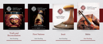
The Indigenous Peoples Atlas of Canada consists of a four-volume book set, an interactive website, downloadable tile maps, teaching guides and resources for teachers. To create the Atlas, editors collaborated with a number of groups and organizations representing Indigenous peoples in Canada, including the Assembly of First Nations, Indspire, Inuit Tapiriit Kanatami, the Métis National Council, and the National Centre for Truth and Reconciliation. The four digital resources comprising the encyclopedia are: Inuit, Métis, First Nations, and Truth and Reconciliation specifically about residential schools, redress, and litigation, an important resource as we prepare to honour and remember residential school survivors during Orange Shirt Day on September 30th.
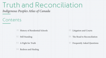
As a powerful education tool, the Indigenous People Atlas in Canada can help move towards reconciliation. The circular logo for the encyclopedias is eye-catching and meticulously conceived, the compass-shaped symbol represents guidance while also evoking the traditional medicine wheel. The visual design was created by Vincent Design of Winnipeg, founded by Métis designer Shaun Vincent. In this atlas, you will find outstanding reference maps of Indigenous people in Turtle Island, as well as a section devoted to Truth and Reconciliation, including detailed pages on many aspects of the topic with contemporary and historical photography, maps and more contents shown below.
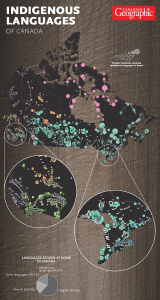
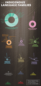
A useful example is the map shown below which illustrates Indigenous languages spoken either as a first or secondary language. The UNESCO Atlas of the World’s Languages in Danger project reports that three-quarters of the nation’s Indigenous languages are “definitely,” “severely” or “critically” endangered. The rest are classified as “vulnerable/unsafe.” Residential schools severed languages across generations, while the reserve system and other colonial policies divided communities from others with shared languages and traditions. The aftermath includes ongoing, widespread language loss and injury to culture, personal identity and community health. Of the millions of Indigenous people, just 15% speak their heritage languages in what we now know as Canada. The revitalization of Indigenous languages is an essential step towards reconciliation, these are the languages of the land beneath our feet.
The atlas was created to help advance education for reconciliation in action, following the recommendations made by the Truth and Reconciliation Commission and expanding the reach of Indigenous peoples history. The interactive website includes a useful search tool where you can find specific things you are looking for. In the video below learn how to use the search tool. The volumes in this atlas series point us collectively in a new direction, a direction that portrays a much more honest and accurate telling of history, and an unfolding of the land, cultures, and identities that existed before colonial powers drew lines on maps and divided families and communities from one another. The Indigenous Peoples Atlas of Canada is a mapping tool towards reconciliation.